
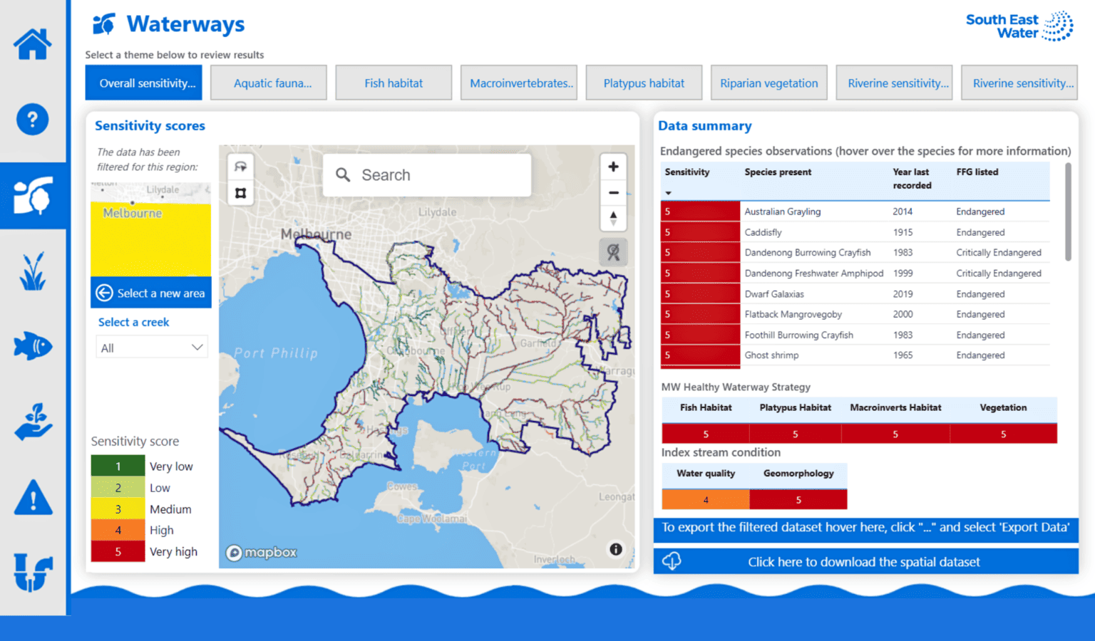
The Environmental Sensitivity Map offers insights for 26 sensitivity categories across local waterways, terrestrial and marine environments. Typing an address into the map reveals information about sensitivities in the surrounding environment with colouring to indicate a 1-5-point sensitivity rating.
On World Environment Day (5 June), South East Water was proud to announce the development of an innovative tool created to identify environmental sensitivities to proactively protect our environment.
The Environmental Sensitivity Map locates key environmental habitats for endangered species and critical vegetation and helps determine the vulnerability of local waterways and wetlands.
Initially, South East Water created the map as an incident response tool. It’s grown to assist with strategic environmental planning, assessments and regulatory requirements, providing an important baseline of understanding for areas of environmental significance within its service area.
The Environmental Sensitivity Map offers insights for 26 sensitivity categories across local waterways, terrestrial and marine environments. Typing an address into the map reveals information about sensitivities in the surrounding environment with colouring to indicate a 1-5-point sensitivity rating.
South East Water worked in partnership with Alluvium Consulting Australia and DiscoverEI to develop the map and dashboard, with datasets obtained through Melbourne Water’s Healthy Waterways Strategy 2018-28, stream habitat indices and the Victorian Biodiversity Atlas to determine locations for endangered species.
South East Water General Manager Liveable Water Solutions, Charlie Littlefair said the map created an important awareness of environmental sensitivities in the field in real-life communities.